Hell Canyon
 Hell Canyon Trailhead
Thanks to Jewel Cave National Monument and National Forest Service land, much of Hell Canyon is open to the public to explore. Jewel Cave is about 13 miles west of Custer, SD on Highway 16, or about 25 miles east of Newcastle, WY. Hell Canyon slopes from north to south, dropping about 4,000 feet from near Bear Mountain to where the watershed empties into Pass Creek, draining an area of around 82 square miles.
There are three areas of Hell Canyon that have defined routes for exploration. The northernmost is the Hell Canyon Trail. In the center of the exploration is the Canyons Trail in Jewel Cave National Monument. Hell Canyon Road (FSR277) provides the only defined access route through the lower part of Hell Canyon. Photos and trail details are posted below.
There are three areas of Hell Canyon that have defined routes for exploration. The northernmost is the Hell Canyon Trail. In the center of the exploration is the Canyons Trail in Jewel Cave National Monument. Hell Canyon Road (FSR277) provides the only defined access route through the lower part of Hell Canyon. Photos and trail details are posted below.
Canyons Trail at Jewel Cave National Monument
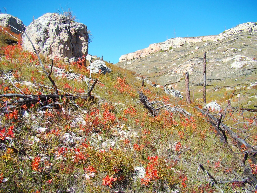
Jewel Cave National Monument has one main trail loop through the area, the Canyons Trail. There are no entrance fees or parking fees at the Monument. Most people who hike the Canyons Trail, start their hike at the Jewel Cave Visitors Center. A few hikers choose to hike from the trailhead at the Picnic Area next to the Ranger Cabin. The trail loop is about 3.5 miles long, with three distinct sections. The section from the Visitors Center to the Ranger Cabin & the old cave entrance, is about 1 mile. From there, the trail drops down to the floor of Hell Canyon and goes about 1.5 miles until it intersects with the third section of the trail, which goes through Lithograph Canyon. The section from the Visitors Center to the junction of Lithograph Canyon and Hell Canyon is about 1 mile long. The total elevation difference from the Visitors Center to the canyons junction is about 300 feet. We would rate the Canyons Trail as an easy to moderate challenge, mainly due to it's 3.5 mile length. To view the Canyons Trail Map, click on the image in the Canyons Trail Gallery below. For more about the hiking trails at Jewel Cave, check out this link: Jewel Cave National Monument Hiking Trails
Jewel Cave National Monument has one main trail loop through the area, the Canyons Trail. There are no entrance fees or parking fees at the Monument. Most people who hike the Canyons Trail, start their hike at the Jewel Cave Visitors Center. A few hikers choose to hike from the trailhead at the Picnic Area next to the Ranger Cabin. The trail loop is about 3.5 miles long, with three distinct sections. The section from the Visitors Center to the Ranger Cabin & the old cave entrance, is about 1 mile. From there, the trail drops down to the floor of Hell Canyon and goes about 1.5 miles until it intersects with the third section of the trail, which goes through Lithograph Canyon. The section from the Visitors Center to the junction of Lithograph Canyon and Hell Canyon is about 1 mile long. The total elevation difference from the Visitors Center to the canyons junction is about 300 feet. We would rate the Canyons Trail as an easy to moderate challenge, mainly due to it's 3.5 mile length. To view the Canyons Trail Map, click on the image in the Canyons Trail Gallery below. For more about the hiking trails at Jewel Cave, check out this link: Jewel Cave National Monument Hiking Trails


Hell Canyon Trail in the Black Hills National Forest
The Hell Canyon Trail starts just at the northwest edge of Jewel Cave National Monument, and is on National Forest land. This section of Hell Canyon is often considered the most rugged and beautiful part of the whole canyon. The trail is a 5.3 mile loop, that offers a .3 mile spur trail to a canyon overlook. The lower part of the trail follows the canyon floor for about 2 miles, then begins a .5 mile ascent up the side of the canyon. The upper part of the trail follows the upper rim of the canyon and drops back down to the canyon floor near the trailhead. This loop trail actually starts in Hell Canyon, but follows the West Hell Canyon branch for the loop. Around .7 mile up the floor trail, a hiker could choose to turn east and follow the main part of Hell Canyon upstream for an "out-and-back". There used to be an old 2-track forest service road there. But, unless you are a seasoned hiker and have left specific hike plans with someone reliable to check on you if you do not return in a specified time frame, we would definitely not advise trying to explore this branch. You could not depend on another hiker finding you if you were injured, since this route is very rarely used. The forest service advises that ticks are in abundance throughout the canyon floor, and rattlesnakes are always a concern. On the upside, there is a herd of bighorn sheep that are often seen high on ledges of the canyon walls (both branches). The Hell Canyon Trail is one we would not term difficult, but because of the length, the rough terrain and the 500 foot rise from floor to rim, it would definitely be what we would call intermediate - not a good trail for anyone with health or mobility limitations. For more information and a map, check out these links:
Hell Canyon Trail Brochure and Map (pdf)


Hiking Hell Canyon Road (FSR277)
The lower part of Hell Canyon sees little traffic, as compared to the Canyons Trail or the Hell Canyon Trail. There is no actual trail through this part of the canyon, just the Hell Canyon Road, also designated Forest Service Road 277. Most of the land is public land, but there are a few pieces of private land as well, with a few small ranches located there. Vehicle traffic is generally very sparse, making this a well-defined route to hike on. The Hell Canyon Road entrance is located about 2 miles west of the main entrance to Jewel Cave National Monument. The road winds around 1.3 miles as it drops to the canyon floor. Then, there are about 12 miles of road heading in a generally southern direction, until the road begins it's route through all private property. Along the sides of the road, are a few short road branches, which go to springs, like Water Draw Spring and McKenna Spring. The Pass Creek Road, the only major road branch, travels east to intersect with other roads in the region. Most of this part of the canyon is less steep and more barren. There are some forested sections, but they are the exception rather than the rule. If you choose to hike here, please respect the few private property and no trespassing signs you do find. There is more about Hell Canyon on our SummitPost: Hell Canyon page.
The lower part of Hell Canyon sees little traffic, as compared to the Canyons Trail or the Hell Canyon Trail. There is no actual trail through this part of the canyon, just the Hell Canyon Road, also designated Forest Service Road 277. Most of the land is public land, but there are a few pieces of private land as well, with a few small ranches located there. Vehicle traffic is generally very sparse, making this a well-defined route to hike on. The Hell Canyon Road entrance is located about 2 miles west of the main entrance to Jewel Cave National Monument. The road winds around 1.3 miles as it drops to the canyon floor. Then, there are about 12 miles of road heading in a generally southern direction, until the road begins it's route through all private property. Along the sides of the road, are a few short road branches, which go to springs, like Water Draw Spring and McKenna Spring. The Pass Creek Road, the only major road branch, travels east to intersect with other roads in the region. Most of this part of the canyon is less steep and more barren. There are some forested sections, but they are the exception rather than the rule. If you choose to hike here, please respect the few private property and no trespassing signs you do find. There is more about Hell Canyon on our SummitPost: Hell Canyon page.


I cried aloud to the LORD, and he answered me from his holy hill. Psalms 3:4
